A remote high-altitude circuit around the world's eighth-highest mountain, crossing Larkya La Pass.
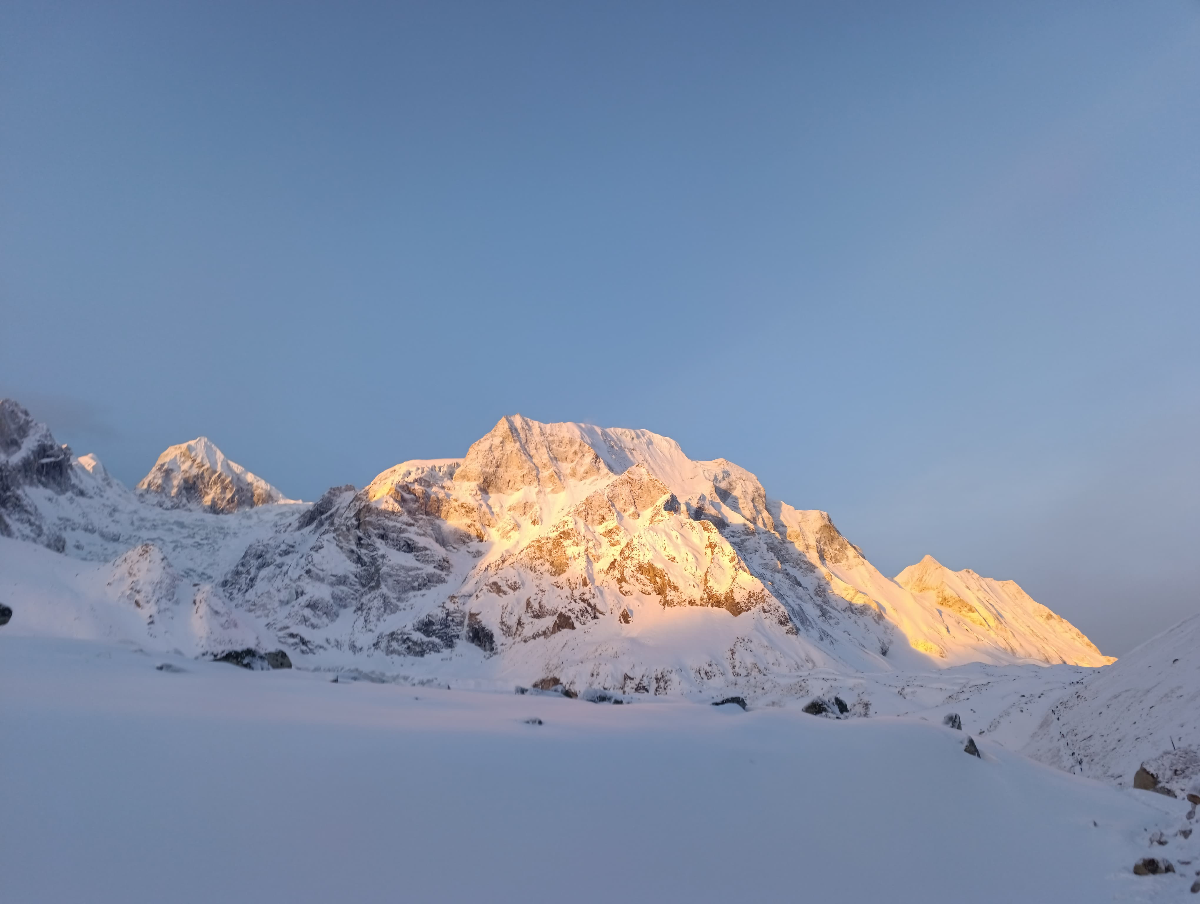
The Manaslu Circuit Trek is one of Nepal's most spectacular and least-crowded high-altitude treks, circumnavigating the world's eighth-highest mountain — Mount Manaslu (8,163 m) — through a remote and culturally rich landscape of Tibetan-influenced villages, ancient monasteries, and dramatic Himalayan scenery. The defining challenge and reward of the circuit is crossing the Larkya La Pass (5,160 m), one of the highest trekking passes in Nepal, with a panoramic arc of Himalayan giants spread across the horizon on crossing day.
Unlike the Annapurna or Everest regions, the Manaslu Circuit remains a restricted trekking area requiring a special permit and a licensed guide — ensuring that the trail retains its unspoiled character and dramatically lower traffic levels. The cultural experience along the route is equally remarkable: the upper Buri Gandaki valley is home to Tibetan Buddhist communities whose traditions, gompas, and prayer flags create an atmosphere found nowhere else in Nepal's trekking landscape.
This 16-day itinerary is carefully balanced to allow proper acclimatization before the high-altitude pass crossing, with two dedicated rest days built into the schedule. It is the recommended pacing for trekkers of moderate to good fitness without prior high-altitude experience on this specific route.
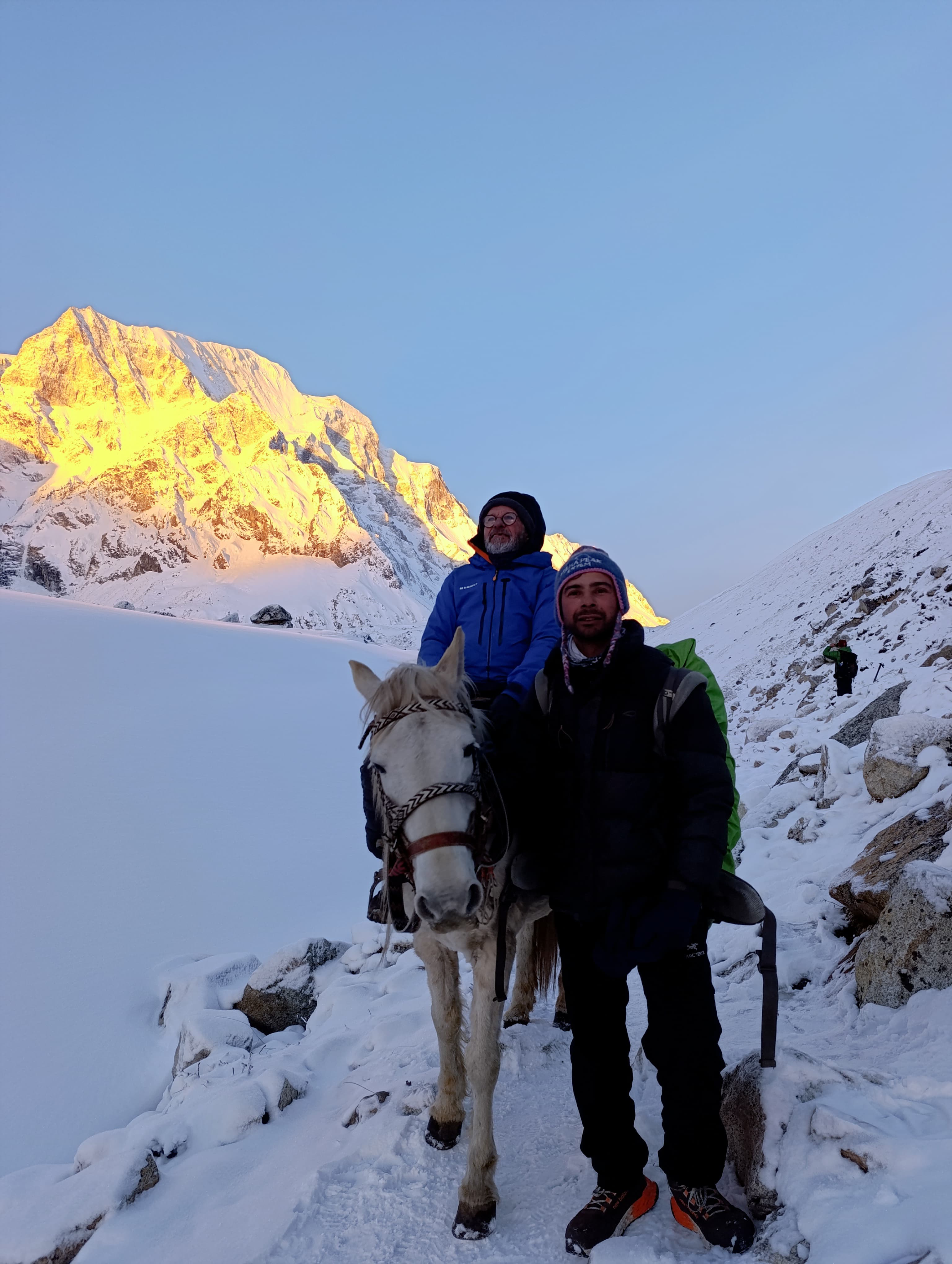
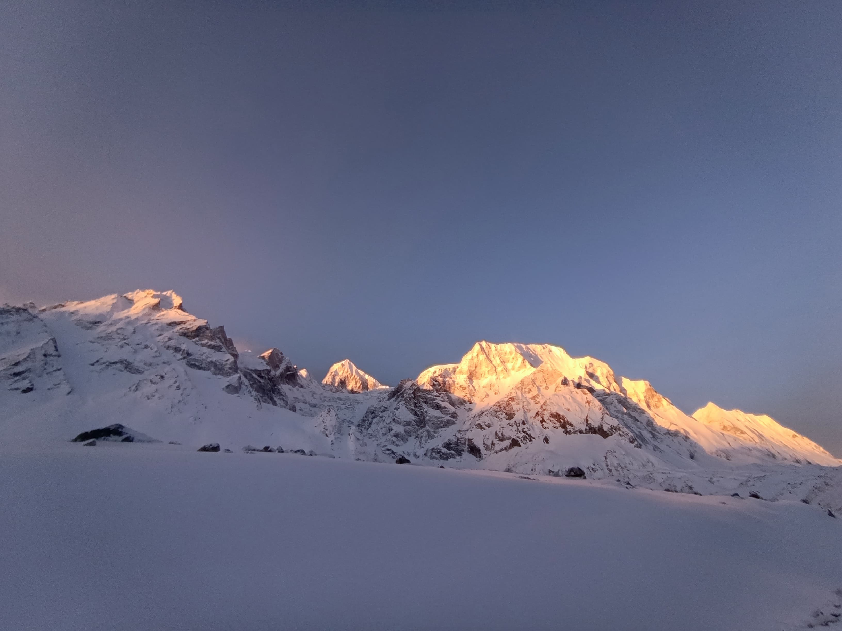
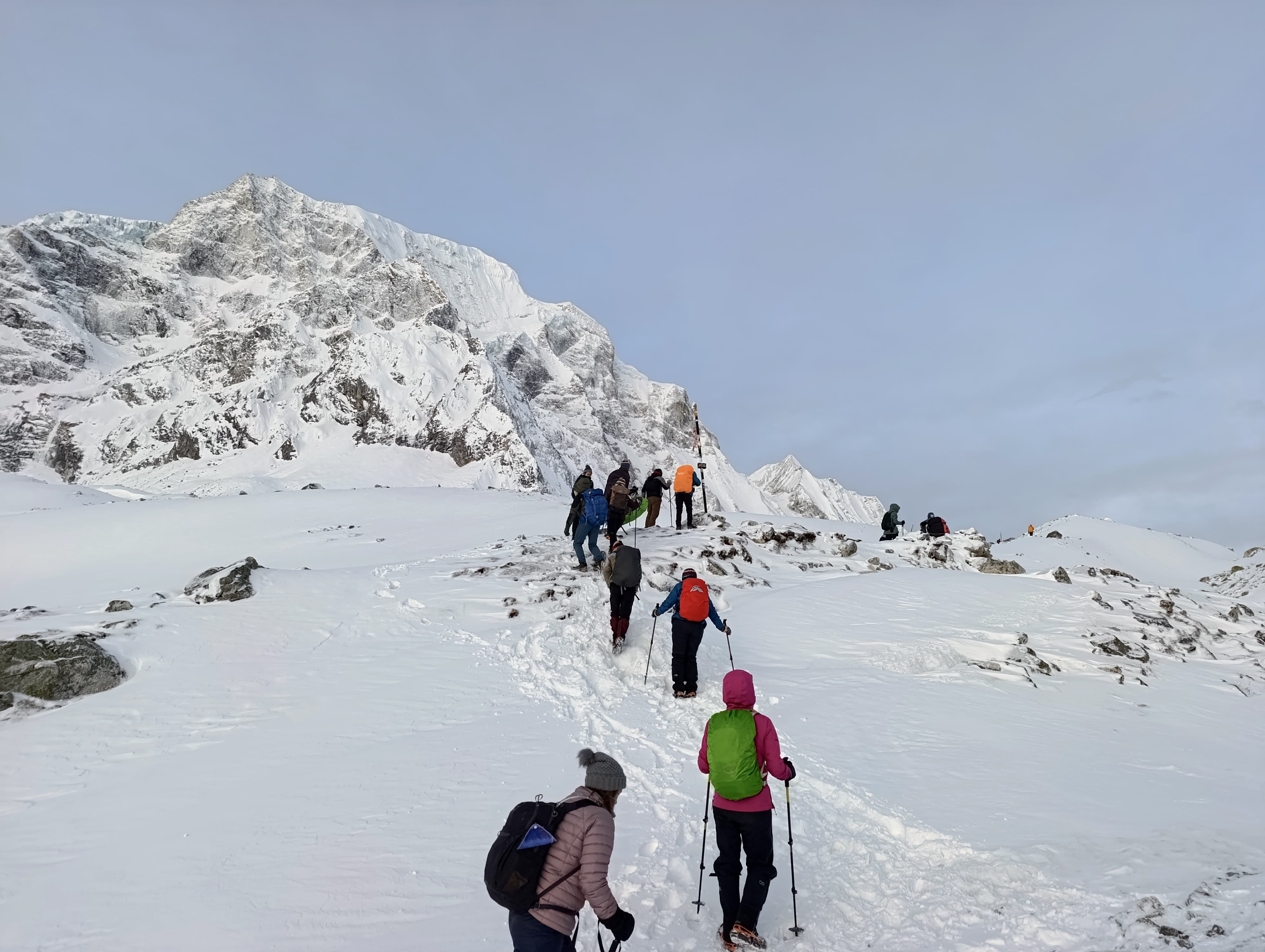
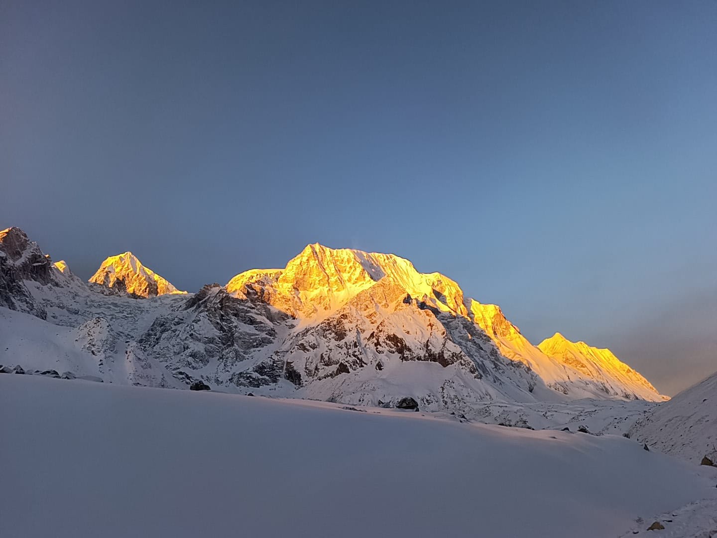
Trail gallery
Drive: 8–10 hrs | Altitude: 700 m | Overnight: Soti Khola
An early departure from Kathmandu begins this epic journey. The drive follows the Prithvi Highway west before turning north up the Buri Gandaki valley — a long but increasingly scenic road journey through the...
Trek: 5–6 hrs | Altitude: 900 m | Overnight: Machha Khola
The first day on the trail is a gentle introduction through classic lower-valley scenery — warm subtropical forest, cultivated terraces, riverside bamboo groves, and cascading waterfalls.
Trek: 6–7 hrs | Altitude: 1,340 m | Overnight: Jagat
A longer and more varied trekking day through the deepening Buri Gandaki gorge.
Trek: 6–7 hrs | Altitude: 1,860 m | Overnight: Deng
The trail continues its dramatic journey through the Buri Gandaki gorge, with the river cutting an increasingly impressive path through the landscape.
Trek: 6–7 hrs | Altitude: 2,630 m | Overnight: Namrung
A day of steady ascent through increasingly dramatic high-mountain scenery.
Trek: 5–6 hrs | Altitude: 3,530 m | Overnight: Samagaon
One of the most scenically rewarding days of the entire circuit. The trail passes through the stunning villages of Lho, Sho, and Shyala — each one a picturesque collection of flat-roofed stone houses set...
Altitude: 3,530 m | Overnight: Samagaon | Optional Hikes Available
A critical rest and acclimatization day before the high-altitude days ahead.
Trek: 3–4 hrs | Altitude: 3,875 m | Overnight: Samdo
A deliberately short and easy day designed to allow gradual acclimatization as the altitude increases.
Altitude: 3,875 m | Overnight: Samdo | Optional Tibet Border Hike
A second acclimatization day at high altitude before the demanding Larkya La crossing.
Trek: 3–4 hrs | Altitude: 4,460 m | Overnight: Dharamsala
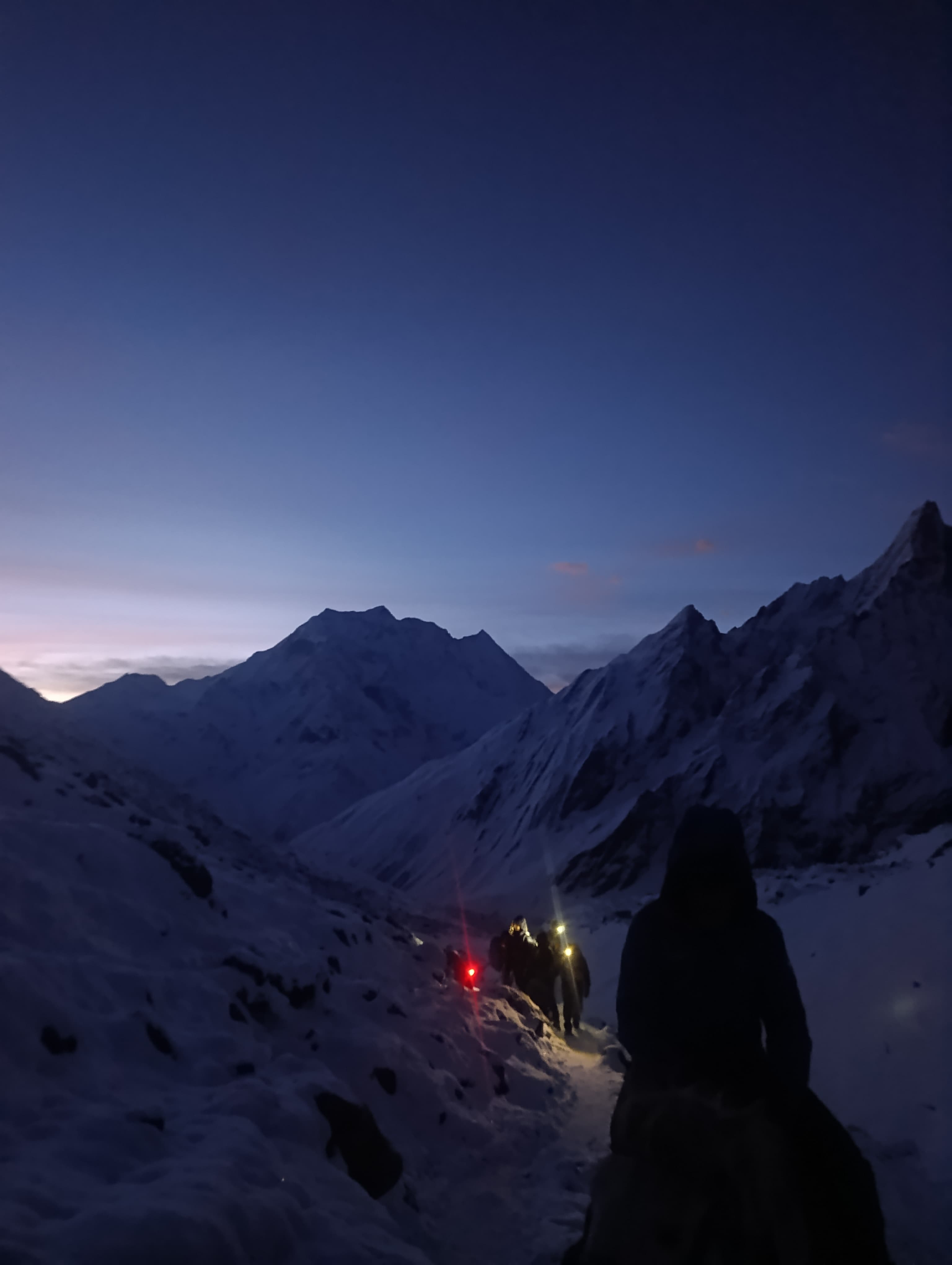
A short but significant day — ascending to Dharamsala (4,460 m), also known as Larkya Phedi or Larkya High Camp, the last teahouse stop before the Larkya La Pass.
Trek: 9–11 hrs | Max Altitude: 5,160 m | Overnight: Bimthang (3,590 m)
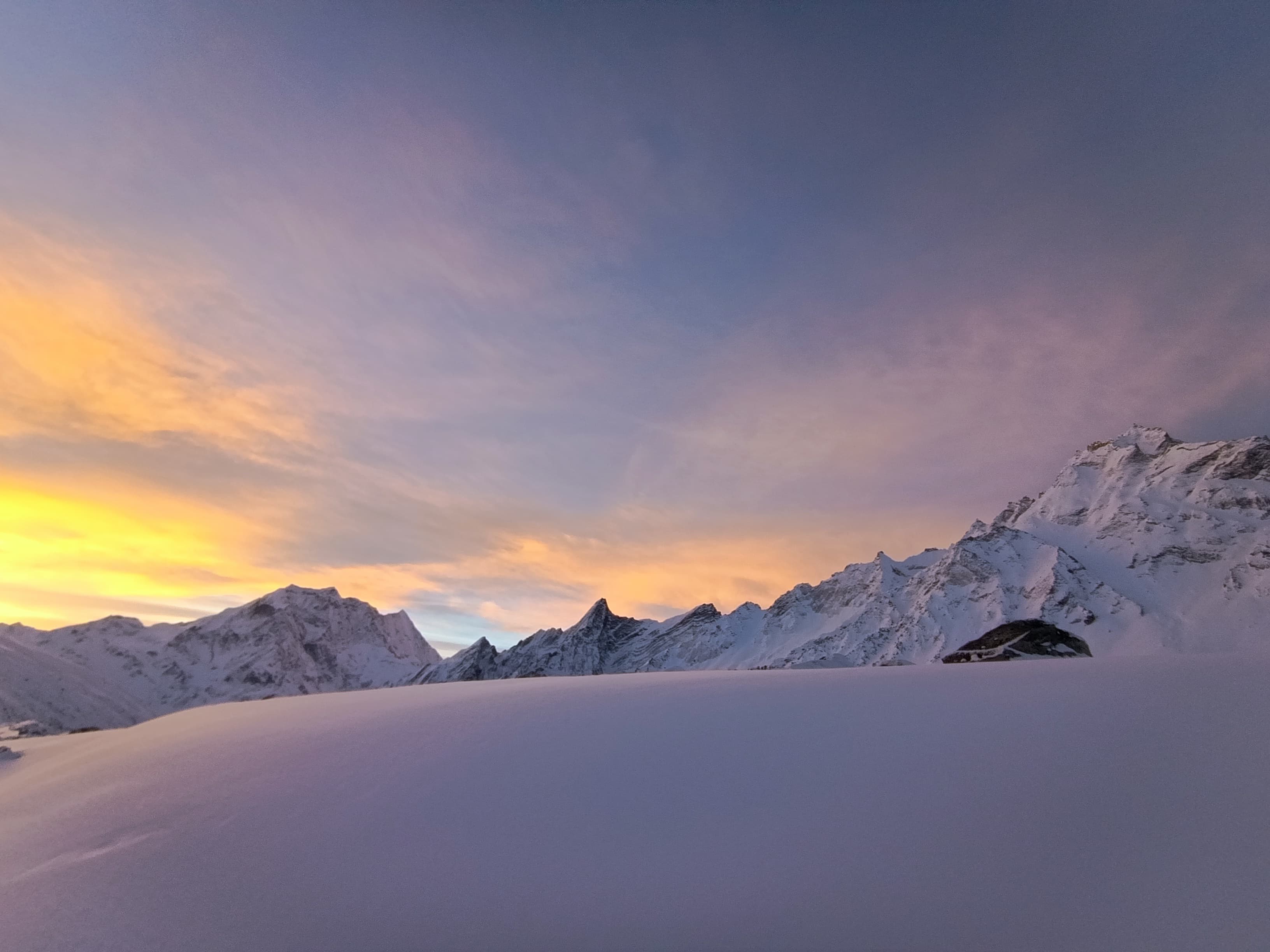
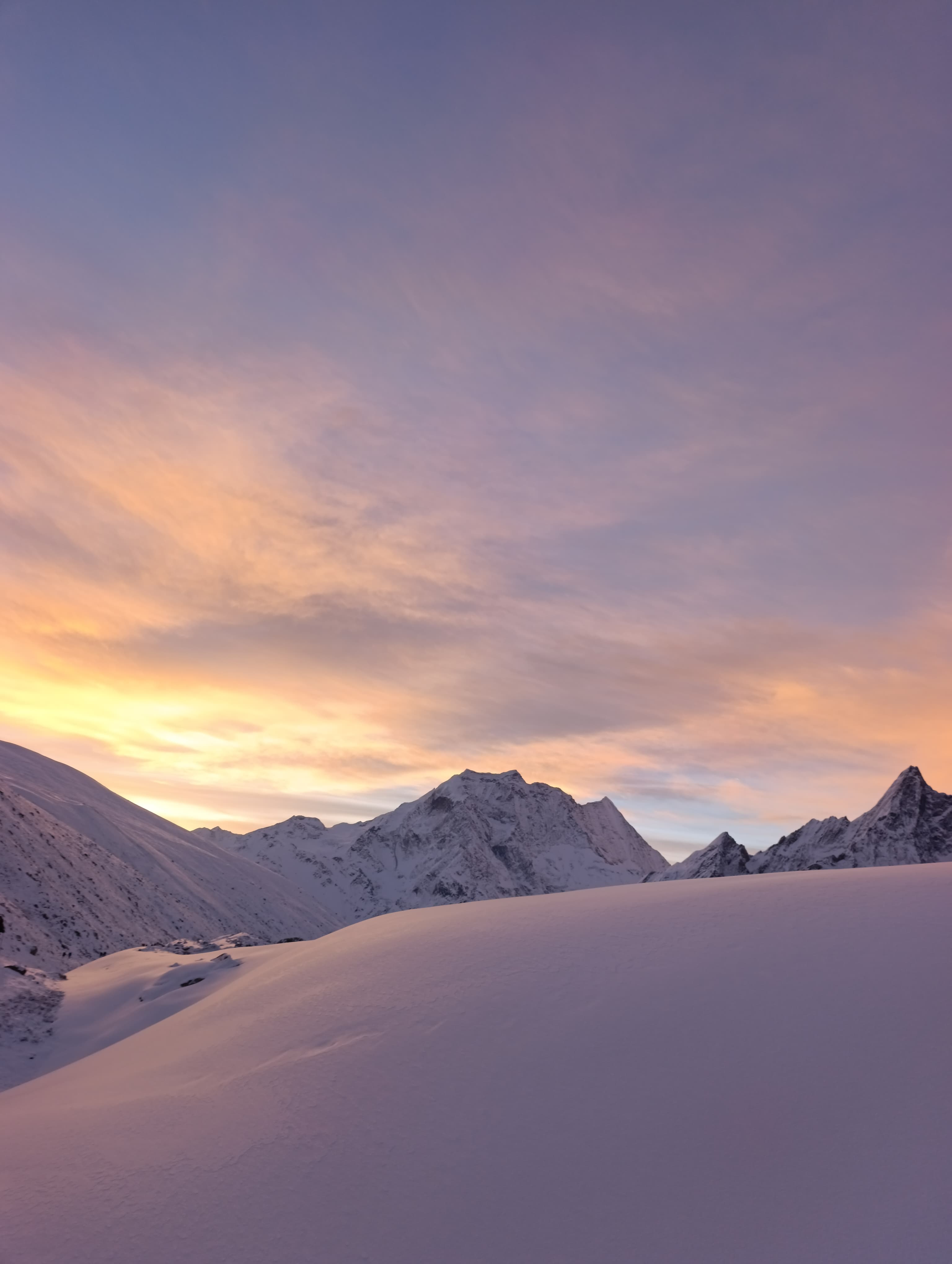
The defining day of the Manaslu Circuit and one of the great high-altitude trekking experiences in Nepal.
Trek: 5–6 hrs | Altitude: 2,300 m | Overnight: Tilije
The day after the pass crossing is one of the most pleasant of the entire trek — a long, gradual descent through increasingly lush and verdant landscape as the altitude drops steadily from 3,590 m to 2,300 m.
Trek: 4–5 hrs | Altitude: 1,960 m | Overnight: Dharapani
The final day of trekking brings the Manaslu Circuit to its conclusion at Dharapani (1,960 m), the junction point where the Manaslu trail meets the Annapurna Circuit route.
Drive: 7–9 hrs | End of Trek
A long but comfortable drive from Dharapani back to Kathmandu via Besisahar and the Prithvi Highway.
| Permit Type | Cost (NPR) | Obtained From |
|---|---|---|
| Manaslu Restricted Area Permit (RAP) — High Season | NPR 35,000 / person (Sep–Nov & Mar–May) | Immigration Office, Kathmandu |
| Manaslu Restricted Area Permit (RAP) — Low Season | NPR 10,000 / person (Dec–Feb & Jun–Aug) | Immigration Office, Kathmandu |
| Manaslu Conservation Area Permit (MCAP) | NPR 3,000 / person | NTB Office or trekking agency |
| Annapurna Conservation Area Permit (ACAP) | NPR 3,000 / person | NTB Office or trekking agency |
| TIMS Card (with agency) | NPR 1,000 / person | Nepal Tourism Board (NTB) |
| Trek Duration | 16 Days / 15 Nights |
| Trek Grade | Moderate to Challenging |
| Maximum Altitude | 5,160 m (Larkya La Pass) |
| Circuit Mountain | Mount Manaslu (8,163 m) |
| Trek Start | Soti Khola (via Kathmandu drive) |
| Trek End | Kathmandu (via Dharapani–Besisahar drive) |
| Best Season | Spring (Mar–May) & Autumn (Sep–Nov) |
| Accommodation | Teahouses / Lodges |
| Meals on Trek | Breakfast, Lunch & Dinner |
| Daily Walking | 4–10 hrs (varies by day) |
| Required Permits | Manaslu RAP + MCAP + ACAP + TIMS |
| Guide Requirement | Mandatory (restricted area) |
Read before you go
Key route details for timing, cash, safety and comfort on this trek.
Carry sufficient NPR cash before leaving Arughat/Soti Khola — no ATMs exist anywhere on the Manaslu Circuit route
A minimum group of 2 trekkers is legally required for the Manaslu Restricted Area Permit — solo trekking is not permitted
Licensed guide is mandatory throughout the restricted area — independent trekking is not permitted
Travel insurance covering helicopter evacuation is mandatory. Carry proof at all times. Verify coverage extends to 5,500 m
Start the pass crossing day no later than 4–5 AM — afternoon weather deterioration can make the crossing dangerous
The Larkya La crossing (Day 11) is the most physically and meteorologically demanding day — ensure you are fully rested and well-acclimatized
Teahouse facilities become basic beyond Samagaon — carry your own sleeping bag rated to −15°C
The itinerary may need adjustment due to weather, altitude sickness, or individual pace — build 1–2 buffer days if possible
Tipping is customary and expected: USD 10–15/day for guide; USD 6–8/day for porter
